Rede de Percursos de Cycling - Alentejo e Ribatejo
Centro Cycling'Portugal de Serpa - Percurso 04 Serpa - Preto
Find other trails from your selection here
Centro Cyclin'Portugal de Serpa - Percurso 03 Serpa - Vermelho
Centro Cycling'Portugal Arronches - Percurso 41 Arronches - Verde
Centro Cycling'Portugal Arronches - Percurso 42 Arronches - Verde
Centro Cycling'Portugal Arronches - Percurso 43 Arronches - Azul
Centro Cycling'Portugal Arronches - Percurso 44 Arronches - Azul
Centro Cycling'Portugal Arronches - Percurso 45 Arronches - Vermelho
Centro Cycling'Portugal Arronches - Percurso 46 Arronches - Preto
Centro Cycling'Portugal da Erra - Coruche - Percurso 11 Erra - Verde
Centro Cycling'Portugal da Erra - Coruche - Percurso 12 Erra - Azul
Centro Cycling'Portugal da Erra - Coruche - Percurso 13 Erra - Vermelho
Centro Cycling'Portugal da Erra - Coruche - Percurso 14 Erra - Vermelho
Centro Cycling'Portugal da Erra - Coruche - Percurso 15 Erra - Preto
Centro Cycling'Portugal da Erra - Coruche - Percurso 16 Erra - Preto
Centro Cycling'Portugal da Serra D’Ossa - Pecurso 06 Freixo - Preto
Centro Cycling'Portugal da Serra D’Ossa - Percurso 01 Freixo - Verde
Centro Cycling'Portugal da Serra D’Ossa - Percurso 02 Freixo - Verde
Centro Cycling'Portugal da Serra D’Ossa - Percurso 03 Freixo - Azul
Centro Cycling'Portugal da Serra D’Ossa - Percurso 04 Freixo - Vermelho
Centro Cycling'Portugal da Serra D’Ossa - Percurso 05 Freixo - Preto
Centro Cycling'Portugal da Serra D’Ossa - Percurso 11 Borba - Verde
Centro Cycling'Portugal da Serra D’Ossa - Percurso 12 Borba - Azul
Centro Cycling'Portugal da Serra D’Ossa - Percurso 13 Borba - Vermelho
Centro Cycling'Portugal da Serra D’Ossa - Percurso 14 Borba - Vermelho
Centro Cycling'Portugal da Serra D’Ossa - Percurso 15 Borba - Preto
Centro Cycling'Portugal da Serra D’Ossa - Percurso 21 Serra - Vermelho
Centro Cycling'Portugal da Serra D’Ossa - Percurso 22 Borba - Vermelho
Centro Cycling'Portugal da Serra D’Ossa - Percurso 23 Serra - Preto
Centro Cycling'Portugal de Almodôvar - Percurso 61 Almodôvar - Verde
Centro Cycling'Portugal de Almodôvar - Percurso 62 Almodôvar - 2 Azul
Centro Cycling'Portugal de Almodôvar - Percurso 63 Almodôvar - Azul
Centro Cycling'Portugal de Almodôvar - Percurso 64 Almodôvar - Vermelho
Centro Cycling'Portugal de Almodôvar - Percurso 65 Almodôvar - Vermelho
Centro Cycling'Portugal de Almodôvar - Percurso 66 Almodôvar - Preto
Centro Cycling'Portugal de Castelo de Vide / Marvão - Percurso 01 Beirã - Verde
Centro Cycling'Portugal de Castelo de Vide / Marvão - Percurso 02 Beirã - Azul
Centro Cycling'Portugal de Castelo de Vide / Marvão - Percurso 03 Beirã - Vermelho
Centro Cycling'Portugal de Castelo de Vide / Marvão - Percurso 04 Beirã - Preto
Centro Cycling'Portugal de Castelo de Vide / Marvão - Percurso 05 Beirã - Preto
Centro Cycling'Portugal de Castelo de Vide / Marvão - Percurso 06 Castelo de Vide - Verde
Centro Cycling'Portugal de Castelo de Vide / Marvão - Percurso 07 Castelo de Vide - Azul
Centro Cycling'Portugal de Castelo de Vide / Marvão - Percurso 08 Castelo de Vide - Vermelho
Centro Cycling'Portugal de Castelo de Vide / Marvão - Percurso 09 Póvoa e Meadas - Vermelho
Centro Cycling'Portugal de Castelo de Vide / Marvão - Percurso 11 Beirã - Verde
Centro Cycling'Portugal de Castelo de Vide / Marvão - Percurso 12 Beirã - Azul
Centro Cycling'Portugal de Castelo de Vide / Marvão - Percurso 13 Beirã - Vermelho
Centro Cycling'Portugal de Castelo de Vide / Marvão - Percurso 14 Beirã - Vermelho
Centro Cycling'Portugal de Castelo de Vide / Marvão - Percurso 15 Beirã - Preto
Centro Cycling'Portugal de Castelo de Vide / Marvão - Percurso 16 Castelo Vide - Verde
Centro Cycling'Portugal de Castelo de Vide / Marvão - Percurso 17 Castelo Vide - Azul
Centro Cycling'Portugal de Castelo de Vide / Marvão - Percurso 18 Castelo de Vide - Vermelho
Centro Cycling'Portugal de Castelo de Vide / Marvão - Percurso 19 Castelo de Vide Beirã - Vermelho
Centro Cycling'Portugal de Castelo de Vide / Marvão - Percurso 20 Póvoa e Meadas - Azul
Centro Cycling'Portugal de Castelo de Vide / Marvão - Percurso 21 Povoa e Meadas - Verde
Centro Cycling'Portugal de Castelo de Vide / Marvão - Percurso de Ligação 1 (BTT XC)
Centro Cycling'Portugal de Castelo de Vide / Marvão - Percurso de Ligação 2 (BTT XC)
Centro Cycling'Portugal de Ourique - Ligação Funcheira-Garvão
Centro Cycling'Portugal de Ourique - Percurso 51 Ourique - Verde
Centro Cycling'Portugal de Ourique - Percurso 52 Ourique - Azul
Centro Cycling'Portugal de Ourique - Percurso 53 Ourique - Azul
Centro Cycling'Portugal de Ourique - Percurso 54 Ourique - Vermelho
Centro Cycling'Portugal de Ourique - Percurso 55 Ourique - Vermelho
Centro Cycling'Portugal de Ourique - Percurso 56 Ourique - Preto
Centro Cycling'Portugal de Serpa - Variante percurso 04 Serpa
Centro Cycling'Portugal de Serpa - Percurso 01 Serpa - Verde
Centro Cycling'Portugal de Serpa - Percurso 02 Serpa - Azul
Centro Cycling'Portugal de Serpa - Percurso 04 Serpa - Preto
Centro Cycling'Portugal do Arripiado - Chamusca - Percurso 01 Arripiado - Verde
Centro Cycling'Portugal do Arripiado - Chamusca - Percurso 02 Arripiado - Azul
Centro Cycling'Portugal do Arripiado - Chamusca - Percurso 03 Arripiado - Vermelho
Centro Cycling'Portugal do Arripiado - Chamusca - Percurso 04 Arripiado - Vermelho
Centro Cycling'Portugal do Arripiado - Chamusca - Percurso 05 Arripiado - Vermelho
Centro Cycling'Portugal do Arripiado - Chamusca - Percurso 06 Arripiado - Preto
Centro Cycling'Portugal do Arripiado - Chamusca - Percurso 07 Chamusca - Vermelho
Centro Cycling'Portugal do Arripiado - Chamusca - Percurso de Ligação Arripiado Erra
Centro Cycling'Portugal Reguengo-Portalegre - Percurso 31 Reguengo - Verde
Centro Cycling'Portugal Reguengo-Portalegre - Percurso 32 Reguengo - Azul
Centro Cycling'Portugal Reguengo-Portalegre - Percurso 33 Reguengo - Azul
Centro Cycling'Portugal Reguengo-Portalegre - Percurso 34 Reguengo - Vermelho
Centro Cycling'Portugal Reguengo-Portalegre - Percurso 35 Reguengo - Vermelho
Centro Cycling'Portugal Reguengo-Portalegre - Percurso 36 Reguengo - Preto
Centro Cycling'Portugal Reguengo-Portalegre - Percurso 37 Reguengo - Preto
Cycling Ribatejo
Cycling Serra d'Ossa
Travessia Cycling Ourique-Almodovar
Travessia Cycling São Mamede
Travessia Cycling Serpa
Search
Centro Cycling'Portugal de Serpa - Percurso 04 Serpa - Preto
Rede de Percursos de Cycling - Alentejo e Ribatejo
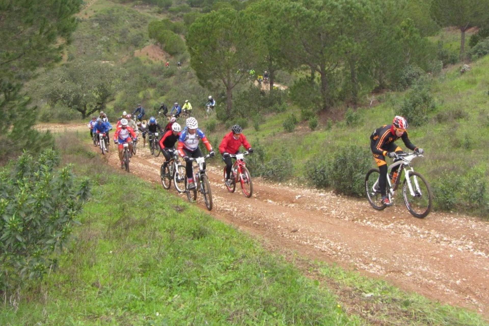
This is the longest and most difficult route from the center. It runs the entire length of the municipality reaching the mountains of Malpique, Adiça and Ficalho. This route follows the same course as the red route as far as Enxoé brook. It is a very long and difficult route that runs the length of the county to arrive at a series of mountains: the Serras de Malpique, Adiça e Ficalho. It is mostly formed of dirt roads for farming and the difficulty increases in the sections near the mountains, where the paths become less "rolling" and more demanding. This route can be made shorter by following the connection shown on the map. It is a signed route, but GPS is recommended.
This is the longest and most difficult route from the center. It runs the entire length of the municipality reaching the mountains of Malpique, Adiça and Ficalho. This route follows the same course as the red route as far as Enxoé brook. It is a very long and difficult route that runs the length of the county to arrive at a series of mountains: the Serras de Malpique, Adiça e Ficalho. It is mostly formed of dirt roads for farming and the difficulty increases in the sections near the mountains, where the paths become less "rolling" and more demanding. This route can be made shorter by following the connection shown on the map. It is a signed route, but GPS is recommended.
View More >
View Less
Directions
https://www.portuguesetrails.com/sites/default/files/trails/kml/PCAR_04_Preto.kml
37.9416
-7.6028
FeedBack
Your opinion is important. Please rate your experience.
Send


